|
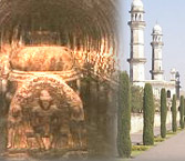
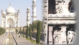
Aurangabad in Maharashtra is a city rich with heritage and culture. The city lies in the western part of the state and is about 403 km from Mumbai. The most important architectures of which the city boasts of are the cave temples. The cave temples describe the excellence of art and architecture that flourished during the ancient period, when these temples were built. Toursitplacesinindia.com is your complete travel site which gives you complete Tourist Information on Aurangabad.
The district of Aurangabad has a long and uninterrupted history from the Jatava period till the present day. The district was under tribal control for a long period in ancient India. However the culture of the district developed during the period of the Satvahana rule, when it witnessed an era of peace and prosperity. The Ajanta caves in Aurangabad dates back to the second century BC and contain sculptures and paintings depicted from Buddhist religious art. Ajanta has a total of 29 caves and is one among the UNESCO World Heritage list. The cave temples of Ellora were built by the Rashtrakuta dynasty in the 7th century AD. Cave 16, which is known as the Kailashnath Temple is a masterpiece art at Ellora. The temple is a splendid achievement of the Dravidian style of art and was started by King Krishna of the Rashtrakuta dynasty who ruled Manyakheta. It took around 100 years to complete this cave. Other noteworthy Hindu caves are the Cave 15 of the Dasavatara cave, which depicts 10 incarnations of Lord Vishnu, Cave 21 and Cave 29. Besides this, there are Buddhist and Jain caves at Ellora too, which depict their respective tradition and philosophy.
According to some historians, the modern city of Aurangabad was founded in the year 1610 AD by Malik Amber, who was the minister of the Nizam of Ahmednagar. The district was called Fatehpura during that period. However the modern name "Aurangabad" was given to the city probably during the reign of the Mughal Emperor Aurangzeb between 1681 AD and 1707 AD. The city lies mostly in the Godavari basin and is drained by the Gadavari and the Godavari River. Other important rivers that pass through the city include Purna, Shivna, Kham, Dudhna, Galhati and Girja Rivers. The district of Aurangabad has a total area of about 10,100 square km of which about 135 square km is under forest cover. The main crops grown here are the Jowar, bajra, cotton and wheat. The city has two multiplexes, 14 movie theatres and three public auditoriums.
Fact File
Area: 10100 square km
Population: 2897013
Altitude: 513m
Languages: Marathi, Hindi, English and Urdu
Best time to visit: November to February
STD code: 0240
Best Season, Climate and Clothing
In Aurangabad the seasons based on the month of occurrence are as follow:
Summer: March to May
Winter: October to February
Monsoon: June to September
The average rainfall of the district is 734 mm and the maximum temperature is 45.9? C.
Although Aurangabad has a moderate climate, it is advisable to visit the city during the winters.
Toursitplacesinindia.com is an international travel site and a repository of useful information which provides you with complete tourist information on Aurangabad.
 |
| 
